Ag + Open Space has an integral role to play in the recovery and long-term resiliency of our entire community, with a specific focus on the conservation and ongoing stewardship of our natural and working lands. In addition to providing local food, clean drinking water, increased biodiversity, and natural beauty, these protected lands also form an important buffer around our communities that can reduce the impacts of fires, floods, and other extreme events.
What we do
Vegetation Management Project Grant Program
In spring of 2021, along with several other County agencies, Ag + Open Space developed a Vegetation Management Project Grant Program to support “shovel-ready” projects that would help increase the county’s resiliency for the 2021 and 2022 wildfire seasons. Ag + Open Space will play a lead role in developing the program further in the years to come. Learn more about this program here >>
During a fire
In any emergency, Ag + Open Space employees often get reassigned to work in the County’s Emergency Operations Center, evacuation centers, and local assistance centers, or perform other duties to support emergency response. During fires, staff are dispatched to help with public information, GIS mapping, and evaluating fire-related impacts to the Russian River, Sonoma Creek, and coastal watersheds through the County’s Watershed Task Force.
After a fire
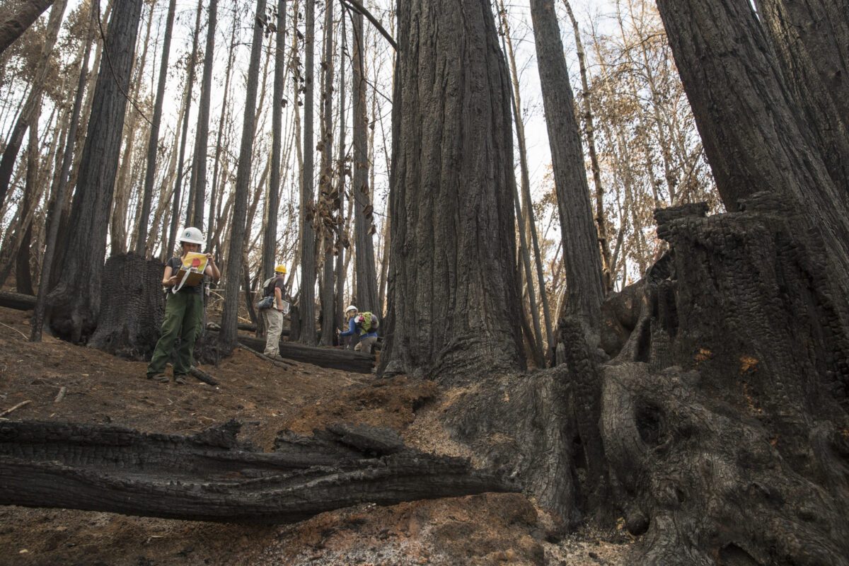
Ag + Open Space remains committed to managing its own lands to ensure ecosystem health and to reduce the risk and intensity of wildfires, and works with easement landowners to support them in doing the same. After a wildfire occurs, Ag + Open Space staff reach out to affected conservation easement landowners to offer support and connect them to resources, such as technical assistance from Sonoma and Gold Ridge Resource Conservation Districts and the Natural Resources Conservation Service, and potential financial assistance from US Department of Agriculture Farm Service Agency, as well as state and local sources (see Resources for Landowners below). We also implement post-fire habitat surveys and develop recovery plans on Ag + Open Space-owned properties that have been affected by fire, and work with partners on other public properties we protect to support their recovery.
Support watershed recovery
After the 2017 Sonoma Complex Fires, Ag + Open Space took an active role in the county’s post-fire watershed recovery and resiliency efforts. With direction from our Board, we convened the Watershed Collaborative – a countywide, multi-agency watershed recovery effort, with a focus on long-term resiliency of our natural and working lands. Together, this group has worked throughout each of the recent fires to develop recovery and resilience plans for local watersheds. High priority actions in the plans address health and human safety concerns related to water quality, landslides, and flooding, as well as impacts to sensitive species and ecosystems. Learn more here >>
Utilize data to understand impacts
Building on a multi-year collaboration with NASA, we map pre and post-fire landscape conditions and assess the impacts of recent wildfires across affected areas and Ag + Open Space protected properties in particular.
While planning for acquisitions, Ag + Open Space relies on high-quality mapping and analysis, fire research, and partnerships with local fire experts to make informed decisions about strategic land conservation investments. We also use these data to update wildfire risk maps to help make decisions about where and how to implement vegetation management practices. These data help us identify areas with high fuel loads to target treatments and evaluate how vegetation communities respond to fire to inform our management practices following a fire.
Impacts of recent wildfires
- The 2020 Glass Fire – part of the LNU Lightning Complex Fires – burned ~5,300 acres of Ag + Open Space-protected land. Saddle Mountain Open Space Preserve, our two additions to Hood Mountain Regional Parks and Open Space Preserve, Rancho Mark West, and the Auberge Ceanothus Preserve burned almost entirely. Several privately-owned properties burned almost entirely, if not completely. For more about how the Glass Fire impacted Saddle Mountain, read more here >>
- Also in 2020, the Walbridge, Stewarts, and Meyers Fires burned ~1,600 acres of Ag + Open Space-protected land. Two easement properties connected to the Austin Creek State Recreation Area burned completely, while one easement property near Armstrong Woods burned over most of the property and another property further north experienced fire on about half of the property. For a look into how the Walbridge fire affected Pryor Ranch, read more here >>
- In the 2019 Kincade Fire, ~14,000 acres of Ag + Open Space-protected land was directly affected by the fires. Five conservation easements located in the Mayacamas Mountains and on the outskirts of Healdsburg and Windsor burned completely, while portions of two additional conservation easements were impacted by the fire.
- During the 2017 Sonoma Complex Fires, ~7,000 acres of protected land was impacted, including the Ag + Open Space-owned Saddle Mountain, Calabazas Creek, and Dogbane Preserves. Read more here >>
Resources for landowners
- County of Sonoma emergency and recovery resources are available here >>
- Sonoma Resource Conservation District offers post-fire assistance, publications, and resources here >>
- UC Cooperative Extension Disaster Resources are available here >>
- The United State Department of Agriculture provides post-fire assistance, publications, and resources here >>
- For Federal disaster assistance visit >>
- Access the California Native Plant Society Fire Recovery Guide here >>
- For more landowner resources, please see our Landowner Resources page >>


