July 24, 2019
Posted in: News Articles
Using GIS data for conservation + community resiliency
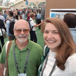
Earlier this month, our GIS Coordinator, Allison Schichtel, and Acquisition Assistant, Curtis Kendall, attended the ESRI User Conference in San Diego. The theme of this year’s conference was See What Others Can’t – in essence, a call to action for GIS practitioners to put their skills to good use in protecting our communities and our planet.
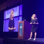
The conference kicked off with a National Security & Public Safety Summit where keynote speakers shared their experiences using GIS to address security and safety issues within communities. Sonoma County Supervisor and Ag + Open Space Director Shirlee Zane was one of the keynote speakers at the Summit, speaking about data, planning, and action for building resilience in Sonoma County. Supervisor Zane shared Sonoma County’s innovation and integration of data and science in responding to and preparing for natural disasters, including fire, flood, and drought. Her talk – delivered to over 400 emergency management officials, first responders, and active military – also showcased our Sonoma Veg Map program, the 2017 Sonoma Complex Fires Story Map and NASA-funded post-fire research.
The actual conference began with a plenary session featuring world-renowned conservationists, E.O. Wilson and Jane Goodall. Wilson spoke of his Half-Earth Project, where he shared that “if we can set aside half of the earth’s surface, and especially if it includes the beautiful natural areas that we’ve held onto, then we can save a very large percentage of all the species on earth, indefinitely. This brings with it a chord of hope.”
Through a discussion of her TACARE project to support sustainable livelihoods while halting the degradation of natural resources, Goodall encouraged the integration of local knowledge with conservation planning. She argued there is no way we can protect biodiversity without engaging with local communities and empowering them to be environmental stewards of their own land. She also spoke of the empowerment of the individual: “If you think globally, you’re so depressed. You don’t want to do anything. But if you say ‘Here in my little community I can clean up this stream if I get people to help me…’ Just doing your bit and knowing that millions of other people are doing their bit is going to make a huge difference.”
Inspired by these international leaders, Allison and Curtis attended workshops and sessions that ranged from field data collection technology enhancements, to tools for collaborating and sharing data with partners and the public, to engaging the community using story maps and dashboards. As an organization, we look forward to using these innovative technologies and tools to support our land conservation work, collaborate more efficiently with our partners, and more effectively communicate the impact and benefits of our work with the community.


