Remote monitoring: A new way to “visit” conserved lands
Conservation easements run with the land forever. As the easement holder, Ag + Open Space works with landowners to ensure the conservation values defined by the easement – agriculture, habitats, watersheds, and more – remain healthy and thriving. To support landowners and the natural and agricultural resources of these lands, we strive to visit each property every 12-18 months. To meet this goal, Ag + Open Space is piloting a “remote monitoring” program.
During a monitoring visit, Stewardship staff meet with landowners and talk though and observe property conditions and how the land is being managed. Staff then write up the observations and photos gathered during the visit into a monitoring report that we share with the landowner. These “snapshots in time” help to capture what’s happening on the land and are a great opportunity to connect with landowners about their successes and challenges.
In between visits, our staff stay in touch with landowners to provide resources, answer questions, and provide guidance on land uses. For instance, if a landowner wants to build a new barn, what are the areas of the property where ag-related structures can be built? Most easements include areas where certain uses are allowed or prohibited. However, easements are often complex documents with multiple provisions that need to be considered when determining whether a use is permitted or not. Stewardship staff are available to help landowners determine which projects are in alignment with the protections outlined by the easement.
While our Stewardship team is mighty, we’re also a small team relative to the number of easements that we hold, and property visits require lots of staff time and are not something we’d ever want to rush. Healthy relationships with landowners take time and effort to build and maintain, and these visits are a critical part of our long-term collaboration. In an effort to balance the need to regularly visit these properties with the reality of how much time it takes to visit and then report on a property, we’ve added another tool to our toolkit – remote monitoring.
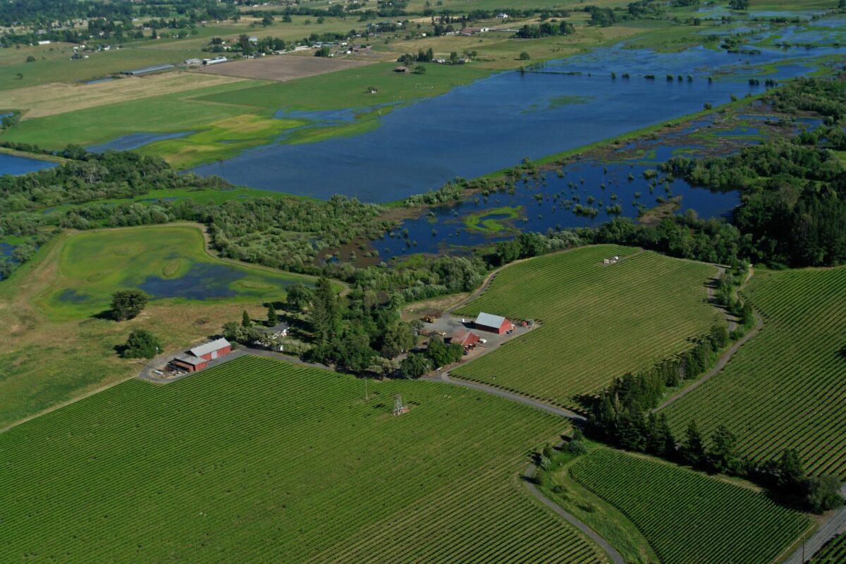
While we’d be one of the first to argue there is no replacement for first-hand observations, this new tool is already proving to be helpful and efficient. Just like an on-the-ground visit, remote monitoring involves a conversation with the landowner to hear how managing their property is going. We also utilize an online remote monitoring platform, Lens by Upstream Tech. This platform allows us to access recent aerial imagery of these properties that we can review and use in our talk with the landowner, and include in our records and monitoring report. We generally use images no more than three months old, and never more than 12 months old, helping to ensure we have a recent picture of the land.
Remote monitoring isn’t a replacement for on-the-ground visits – for instance, properties are generally only eligible for remote visits if we’ve been on the ground in the last few years. We also wouldn’t remotely monitor a property that had a current violation of the easement (i.e. building outside of the areas outlined for structures in the easement), or if the land had recently been bought by a new landowner. Remote monitoring is essentially a tool that helps us “visit” more often.
We’ve also found some unexpected perks – with aerial imagery, we can more clearly see remote parts of properties that might otherwise be completely inaccessible. This imagery allows us to have a more holistic picture of the land. With the pandemic, wildfire, floods, and more, it’s also not always possible for us to get out for in-person visits, but remote monitoring allows us to be flexible and adaptable.
As the world rapidly evolves, we are constantly challenging ourselves to seek out new and better ways to do our work, and remote monitoring has quickly become a useful tool that helps us better support landowners in caring for our natural and working lands.