December 29, 2020
Posted in: News Articles
Resilience lessons on our protected lands
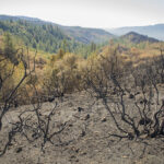
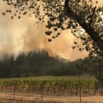
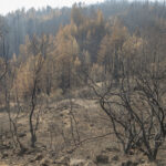
After the 2017 Sonoma Complex Fires, Ag + Open Space led a study to evaluate how those wildfires impacted vegetation within burn zones. Since then, we’ve been honored to share the findings with local government agencies, land conservation organizations, and most recently in a California Department of Fish & Wildlife (CDFW) Special Fire Issue, which was released this month.
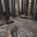
The goal of this study was to use post-fire aerial imagery to map areas where the canopies, or tops of trees and shrubs, burned in the 2017 fires, and to then use those data to determine how differences in land cover type, topography, vegetation structure (e.g., how tall a tree is or how dense its branches), climate and weather, and proximity to streams might explain some of the patterns of canopy damage. When fire spreads to the canopy, called a crown fire, it can lead to higher tree mortality. You can read more how crown fires affect our lands in our blog post about the Walbridge Fire’s impacts on Pryor Ranch.
Our study found that vegetation near streams was the least damaged by the fires, and that shrubs and conifers (including the fire-adapted knobcone pine) were the most damaged. In general, areas with more canopy damage were further from streams and had a higher density of ladder fuels, which are low-lying branches and shrubs that can carry fire from the ground to the canopy.
With these post-fire maps of canopy damage in hand, Ag + Open Space and our partners have a better baseline understanding of how the 2017 fires impacted our landscapes. Now, we use these baselines to study how different types of vegetation respond to fire over time. And studying how our lands respond to fire over time helps us to better understand the overall health of these forest ecosystems and their resilience in the face of future wildfires.
We can also use these maps to identify areas for restoration and fuel management work that will best promote ecosystem health and support community safety and disaster preparedness. By accurately and efficiently mapping ladder fuels, vegetation type, and vegetation structure, Ag + Open Space and our partners can prioritize treatments based on the location of heavy fuel.
To dive deeper into our findings, you can read the full article here >>
Check out the full 2017 Sonoma Complex Fires Story Map here >>
This work builds upon the Sonoma County Vegetation Mapping & LiDAR Program, a multi-year effort led by Ag + Open Space and Sonoma Water and in partnership with NASA and the University of Maryland, California Department of Fish & Wildlife, the United States Geological Survey, County of Sonoma Information Systems Department, County of Sonoma Transportation & Public Works Department, California Native Plant Society, Save the Redwoods League, and the Natural Conservancy.


